 Add Row
  Add
Add 
Did you know nearly 30% of travelers lose connectivity during trips? In an always-on world, nothing disrupts an adventure, road trip, or even a simple city commute more than suddenly losing your signal. Offline maps apps are transforming the way we navigate, allowing us to find our way anywhere—even when there’s no WiFi or data connection. This comprehensive guide will help you discover the power of offline navigation tools, whether you’re a hiker, a globetrotter, or just want stress-free confidence that you’ll never end up lost again.
Stay Connected Everywhere: The Growing Need for Offline Maps Apps
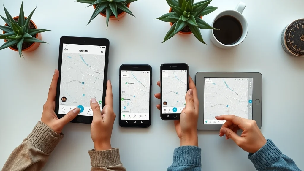
Modern travel and outdoor activities are increasingly reliant on digital navigation. Yet, even in 2024, signals can drop unexpectedly—in tunnels, mountains, rural areas, or simply when traveling abroad without an international plan. Offline maps apps play a critical role in ensuring continuous access to detailed map data, navigation, and location info without depending on an internet connection. When the network fails, these apps safeguard your journey, reducing stress and cutting the risk of getting lost or missing road events, public transport routes, or hiking trails.
Whether you’re using Google Maps or a dedicated offline map tool like Organic Maps, the ability to download the map in advance and use it anywhere is indispensable. Features like offline route planning, detailed maps, and current location tracking make these solutions ideal for road trips and remote explorations. Plus, with bug fixes and privacy practices improving yearly, these apps have quickly become a must-have on every mobile device, outpacing paper maps and offering far better accuracy for modern explorers.

- Did you know nearly 30% of travelers lose connectivity during trips?
- Discover how offline maps apps ensure seamless navigation when network fails.
What You'll Learn About Offline Maps Apps
- Advantages of offline maps apps
- Leading offline map options reviewed
- Key features and how they benefit you
- Comparison: offline maps vs. google maps
- Tips for hikers and international travelers
Top Offline Maps Apps: Features, Prices, and User Reviews
Choosing the right offline maps app depends on your unique needs. This table compares leading options, including Organic Maps, Offline Map, Google Maps (offline mode), and other specialized offline maps. Factors like platform support, pricing, privacy practices, bug fixes, and usability make each platform distinct. Here’s a quick side-by-side to help you pick the perfect navigation companion for your next journey.
| App | Features | Pricing | Platforms | User Rating |
|---|---|---|---|---|
| Organic Maps | Open-source, privacy-focused, topographic maps, hiking trails, public transport info, frequent bug fixes | Free | iOS, Android | 4.7/5 |
| Google Maps (Offline Mode) | Basic offline maps, turn-by-turn, public transit, route color coding, limited storage | Free | iOS, Android | 4.4/5 |
| Offline Maps & Navigation | Offline route planning, transport route options, voice guidance, regular bug fixes | Free / Premium | iOS, Android | 4.2/5 |
| Maps.me | Offline maps, hiking trails, walking directions, hotels, frequent updates | Free / In-app purchases | iOS, Android | 4.3/5 |
Organic Maps: The Open-Source Offline Map Solution
Organic Maps has quickly risen to prominence among serious travelers, hikers, and privacy-conscious users. Unlike many proprietary navigation tools, this offline map leverages OpenStreetMap data and places a strong emphasis on privacy practices—no tracking or linking to your identity. It’s especially well-suited for hiking trails and adventure travel, thanks to accurate topography and route color options, as well as track filtering for easy journey planning. Organic Maps works fully offline and updates frequently with bug fixes, ensuring it remains a reliable choice for those off the beaten path.
For anyone unsure about which maps app to trust on a long trip or off-grid adventure, Organic Maps stands out by supporting SD card downloads and lightweight storage, helping conserve mobile device space. Because it’s open-source and regularly improved by a global community, you benefit from the very latest road events, transport route changes, and map detail enhancements for stress-free navigation in any environment.
Key Features of Organic Maps for Offline Navigation
Organic Maps is revered for keeping navigation private and seamless, even in remote areas. With frequent bug fixes and robust offline storage on SD cards, it offers a major upgrade over traditional paper maps. You can access walking directions, hiking trails, cycling routes, and public transport info—all without an internet connection. The search function is intuitive, making route planning painless and ensuring your current location is always clear on the detailed map. For long time travelers and locals alike, Organic Maps’ open-source model means faster updates and better privacy practices than most competitors.
Lightweight downloads mean you can store maps for entire countries on your device. Frequent users appreciate that route color and track filtering features help distinguish added tracks for different activities—especially helpful when hiking multiple trails in a day. Organic Maps is perfect for international travelers who want to avoid roaming fees, offering reliable offline navigation for any trip from city breaks to multi-day hiking trails.

- Open-source and privacy-focused
- Supports hiking trails and cycle routes
- Lightweight offline maps for global travel
"Organic Maps changed my hiking experience—no more dead zones in remote areas!" – Real User Review
Google Maps Offline: Best for Reliable Everyday Navigation
For daily commuters and frequent travelers, Google Maps remains the go-to app, and its offline functionality has improved notably in recent years. The Google Maps app’s ability to download maps of specific regions means you can still use turn-by-turn navigation, see road events, and even find hotels and public transport info when you’re not connected. While its storage limit and offline update frequency don’t quite match specialized offline map apps, for many, the familiar interface and continual bug fixes make it a top choice for everyday travel and road trips.
The convenience of using Google Maps offline is invaluable if you anticipate spotty signals—whether due to geographic location or data plan limitations. However, functionalities like real-time public transit updates and traffic conditions only work online, and some map detail and search function capabilities may be restricted when fully offline. Overall, Google Maps serves as an excellent backup tool, supporting both everyday navigation and emergencies—especially in urban environments.
How to Use Google Maps Offline Map Functionality
Google Maps offline use is straightforward. Start by searching for your intended area, then opt to download the map. You can use offline navigation for driving, walking, or cycling directions, but keep in mind that live road events, public transport times, and route color updates are only refreshed when you reconnect. The Google Maps app will notify you when it’s time to update maps, ensuring accuracy for long trips. Navigation may be limited if you need to venture beyond downloaded areas or want access to up-to-date pedestrian or public transit info, but for most users, these limitations are minor compared to the core functionality provided.
- Steps to download an offline map in Google Maps
- Navigation with limited or no network
- Limitations compared to dedicated offline maps apps
Choosing the Best Offline Map: Comparison of Offline Maps Apps for Every Need
How do you decide which offline maps app is truly right for you? Comparison comes down to core priorities such as offline map storage limits, update frequency, hiking trail accuracy, ease of use, and multi-device compatibility. The following table breaks down the leading options for a more informed decision on your navigation needs, covering road trips, hiking trails, and international adventures.
| App | Offline Storage Limit | Update Frequency | Best for Hiking Trails | Multi-device Compatibility |
|---|---|---|---|---|
| Organic Maps | Large areas; SD card support | Frequent (community-driven bug fixes) | Yes – Topographic, cycling & hiking trails | iOS & Android, sync via openstreetmap account |
| Google Maps (Offline Mode) | Up to 2GB per region | Moderate (auto-update option) | Moderate (less trail detail) | iOS & Android, Google account sync |
| Offline Maps & Navigation | Varies; expandable with SD card | Regular | Yes | Multiple devices with cloud account |
| Maps.me | Full countries | Frequent community updates | Yes | iOS & Android, sync with email |
- Offline maps apps for hiking trails
- Budget-friendly options versus premium
- Interface, usability, and custom layers
How to Download Maps Offline for Free: Step-By-Step Tutorial
Getting started with offline maps apps is easy and budget-friendly. Many top applications, like Organic Maps, Google Maps, and Maps.me, offer generous free features and quick setup for instant offline use. Here’s a straightforward workflow to maximize your offline navigation experience:
- Select your preferred offline maps app: Explore which interface best fits your needs—whether you want privacy, hiking trail detail, or public transit info.
- Search area or region for download: In the app, use the search function to find your desired city, region, or custom area.
- Adjust map storage settings: Choose to save to SD card if using devices with expandable storage, and select how much map data to download for offline access.
- Update maps for consistent accuracy: Periodically connect to WiFi or mobile data to apply bug fixes, public transport changes, and the latest road events or added tracks.
Offline Maps Apps for Hiking Trails and Adventure Seekers
For adventurous users, having a reliable offline map makes all the difference on the trail or in the backcountry. Hiking-specific apps go beyond basic map detail—they offer topographic overlays, custom route color features, and robust offline route planning, ensuring you never lose track of your location, even on the longest journey. With options to plan, filter tracks, and log hiking trails, these tools offer vital safety for remote regions without mobile service.
Real-world adventure enthusiasts rely on lightweight downloads, bug fixes tailored to hiking terrain, and up-to-date data, from new arrow color markers to transport route changes. Safety comes first—these apps allow you to avoid hazards and accurately track progress, all while making the most of limited device storage and energy. Stories from hikers on mountain overlooks to those exploring remote forests echo a similar refrain: “With offline maps, we travel further, safer, and smarter—no matter how far off the grid we go.”

- Features supporting hiking trails: topographic detail, offline route planning
- Real-world use cases from adventure enthusiasts
- Safety and reliability in remote locations
To truly grasp the power of offline navigation, watch travelers use these apps in the real world. The following video demonstrates a range of scenarios—from bustling global cities to quiet backcountry hiking trails and remote rural roads—showing exactly how offline maps apps give users seamless confidence, even when signals are lost. You’ll see close-up interactions with map tools, quick location checks, and smooth transitions between regions, all without mobile data or WiFi. It’s a must-see for anyone considering going off-grid.
Watch how offline maps apps keep travelers on track during global journeys, including hiking trails and urban adventures.
People Also Ask: Frequently Asked Questions About Offline Maps Apps
Which app is best for offline maps?
- A review of Organic Maps, Google Maps, and specialized offline maps apps shows each has its niche. Organic Maps is best for privacy and hiking trails, Google Maps excels for everyday commuters and tourists, and specialized offline maps apps like Maps.me offer comprehensive maps, easy download options, and updated bug fixes. Choose based on travel habits, privacy needs, and whether you need advanced features like track filtering, public transport overlays, or frequent offline updates.
How can I download maps offline for free?
- Most offline maps apps allow free region or country downloads. In each app: search for the desired area, select download, adjust SD card or internal storage preferences, and set update reminders for applying bug fixes. Apps like Organic Maps and Maps.me keep downloads unlimited and ad-free, while Google Maps covers popular areas with some feature limitations. Periodically update to maintain accuracy, especially for hiking trails and new road events.
Which map app works without internet?
- Many modern map tools work offline: Organic Maps, Google Maps (offline mode), and Offline Maps & Navigation do not require an internet connection for basic navigation. For full features, like public transport or walking directions, ensure maps are fully downloaded in advance. Even specialized hiking trail apps allow route planning and track filtering completely offline, providing reliable direction, route coloring, and error-free navigation no matter where you venture.
Which map does not require internet?
- Several offline maps apps promise complete offline usability: Organic Maps, Maps.me, and Offline Maps & Navigation (with maps saved), guarantee that no data connection is required after the initial download. These tools are designed for long time travel, remote hikes, and international trips where connectivity can’t be trusted. They include up-to-date bug fixes, privacy practices, and support for SD cards, ensuring maximum reliability.
Key Takeaways: Why Offline Maps Apps Matter

- Offline maps apps provide reliable navigation anywhere
- Ideal for international travel, hiking, and emergencies
- Multiple offline maps apps tailored for different needs
Expert FAQs: Navigating the Offline Maps Apps Landscape
-
How secure are your offline data?
Most offline maps apps, particularly Organic Maps, are privacy-focused, with no data linked to your identity, no ads, and strict controls over your location info. Always review privacy practices before downloading. -
How often should you update offline maps?
Update before every significant trip or monthly to ensure bug fixes, new road events, and added tracks are included. Regular updates avoid encountering outdated info and ensure route accuracy. -
Tips for conserving device storage with offline map downloads
Download only the regions you need. Use SD card storage if available. Delete old or unused map files after your journey for optimal device performance, especially when prepping for a long time road trip or adventure.
Conclusion: Find Your Way—Anywhere—with Offline Maps Apps
- No matter your journey, offline maps apps are the modern traveler’s must-have tool for travel confidence and safety.
"After downloading an offline map, I never worried about getting lost again." – Satisfied User

- Please like, share and comment on this article


Write A Comment